Text and Images by Amanda Villarosa
Los Angeles isn’t traditionally considered to be the friendliest place for those who like to walk, and it takes, at the very least without traffic, 20 minutes to drive anywhere in LA County.
Again, if you’re lucky.
Maybe that’s why local Angelenos enjoy hiking so much: all those hours spent in our cars, commuting to and from work, or these days being stuck at home working, has perhaps inspired residents to explore the city’s natural environments more.
Add to that the allure of Southern California’s sunshine and the fact that an outdoor lifestyle can be so easily achieved — in fact, it’s culturally encouraged (SoCal sees over 300 days of sun each year).
I was born and raised in LA County, but as an adult, I’ve traveled extensively as a photographer and lived on the opposite coast. It’s always special for me to come back and discover what home can still offer: paths untaken, views unseen, and the chance to explore my city with fresh eyes.


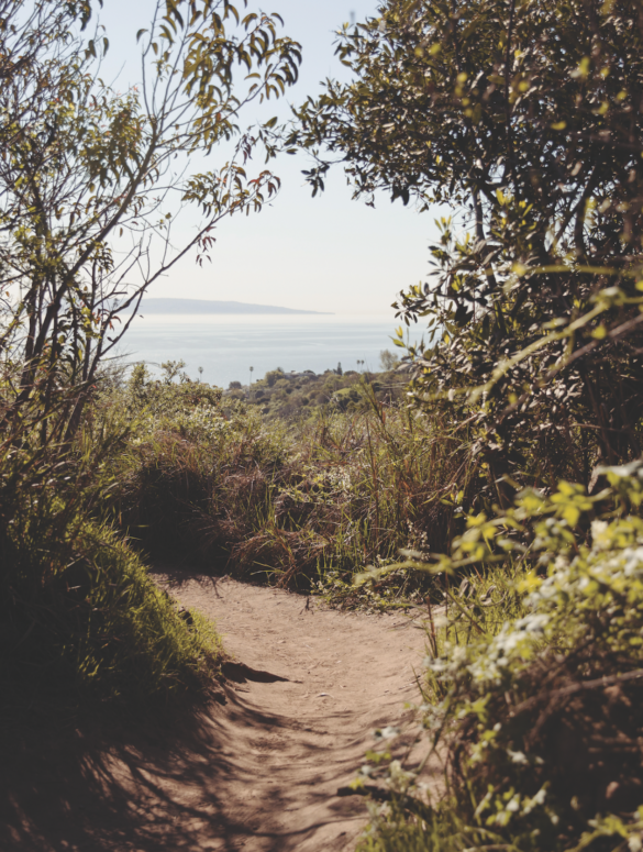
The Los Liones Trail, right off Sunset Boulevard near Santa Monica, is popular amongst westsiders, but was new to me, an inland LA local. Sometimes spelled “Leones,” the Los Liones Trail was named after the local mountain lions (according to the National Park Service, sightings are “extremely rare”), and is located in the Santa Monica Mountains, a range that was originally part of the homelands of the native Tongva and Chumash people.
Today, this area is called Pacific Palisades, home of the Getty Villa, and neighbor to Brentwood, Malibu, and Santa Monica.
The trail is considered moderately challenging, and ascends up from the south end of Topanga State Park. It’s heavily trafficked on weekends (like I said, Angelenos love to hike), but my friends and I were lucky to have it mostly to ourselves on a Wednesday morning, and we quickly discovered what makes this hike so special: It’s one of the most scenic hikes I’ve done in the city, with a canyon full of lush chaparral and sage brush and ivy, winding paths through wildflowers and rolling green hills of grasses, and an expanding view of the ocean as you climb higher.
It’s always special for me to come back and discover what home can still offer: paths untaken, views unseen, and the chance to explore my city with fresh eyes.
Amanda Villarosa

Topanga State Park is the world’s largest wildland within the boundaries of a major city, and it doesn’t disappoint.
We took our time, soaking in every turn and vista, only pausing to take photos along the way. You’ll stop quite often. About 1.5 miles up and requiring around 2.5 hours, the trail opens on to a mesa, and you’re rewarded with the first full view of LA: the snow-capped San Bernardino Mountains framing the towering skyscrapers of Downtown transition to Santa Monica Bay and the Pacific Ocean, with Catalina Island visible in the distance on a clear day.

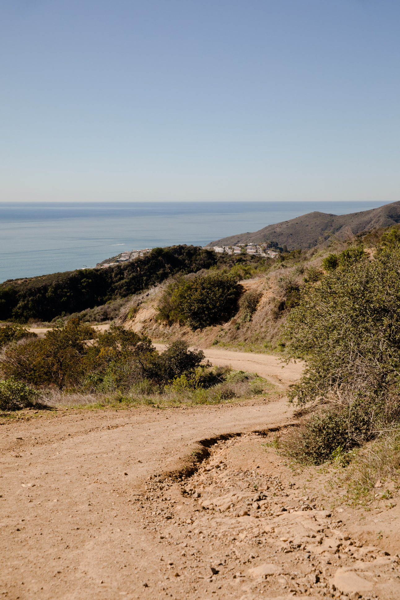
Parker Mesa Overlook provides sweeping views of Santa Monica Bay below you and panoramic views of the Pacific Ocean, and the coastline that spans from Palos Verdes to Malibu.
From there, you have a choice to continue higher for more expansive views of Temescal Ridge and the houses off Palisades Drive. Or follow a trail that descends toward the ocean, or turn back. Warning: It will be hard not to spend time taking in the vista and enjoying the serenity it offers.

After sitting for a moment to take in this spectacular view we decided to head back down, as that famous LA sun rose higher in the midday sky.
To access Los Liones Trail, take Sunset Boulevard (off the PCH) 0.3 miles and turn left onto Los Liones Drive. There are two staging areas, both on the right side of the road, along with multiple trailheads to the east.